

Latest Weather Blog
Tropical Disturbance Worth Monitoring, But No Immediate Concern for Louisiana
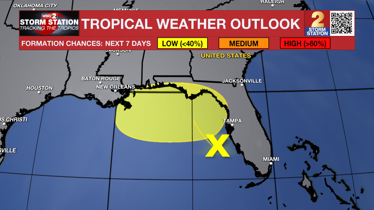
While the Atlantic remains relatively quiet, the National Hurricane Center is keeping an eye on an area of disturbed weather over the eastern Gulf near Florida. At this point, there's no indication the system poses a threat to Louisiana, but it's a reminder that hurricane season is entering the time of year when Gulf residents should stay weather aware.
What's happening?
The disturbance is associated with an upper-level low and a weak surface trough over the eastern Gulf. It's producing widespread showers and thunderstorms near Florida's west coast, but it remains disorganized. The National Hurricane Center gives the system just a 20% chance of developing over the next 48 hours and a 30% chance over the next seven days as it slowly drifts north or north-northwest toward the Florida Panhandle. The biggest concern, regardless of whether it becomes a named system, is the potential for several days of heavy rainfall and localized flooding across parts of Florida and the eastern Gulf Coast.
Why weather enthusiasts are paying attention
Although the development odds remain low, forecast trends have become a little more interesting over the past couple of days. Earlier forecasts kept the disturbance tucked closer to Florida. More recent guidance and National Weather Service discussions have shifted the potential area of development slightly farther west into the eastern Gulf. The National Weather Service in Tallahassee also noted that the chance for development has "crept upward" and that the area favorable for development has expanded westward, although they continue to emphasize that tropical development is still far from certain.
One reason for the uncertainty is that the system currently lacks a well-defined surface circulation. It's being driven primarily by an upper-level low, and systems like this often struggle to organize into tropical cyclones. However, if thunderstorms can persist over warm Gulf waters long enough, gradual development remains possible.
Trending News
What does this mean for Louisiana?
For now, not much. High pressure centered over the north-central Gulf continues to dominate our weather, and current forecasts keep any potential tropical development focused much farther east, near Florida. While forecast models have shown a slight westward trend, they still do not bring a significant impact to Louisiana at this time. Of course, anyone who lives along the Gulf Coast knows tropical forecasts can change, so it's worth checking back over the coming days.
A good reminder to prepare
Even when the tropics are quiet, this is the perfect time to make sure your hurricane plan is ready. Review your evacuation plans, check your emergency supplies, and make sure you have multiple ways to receive weather alerts. Waiting until a storm is approaching Louisiana is never the best time to prepare.
July is usually one of the quieter months
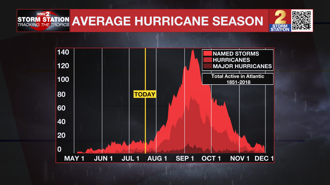
Historically, July has not been a particularly active month for Louisiana tropical landfalls. Only a handful of tropical systems have reached the Louisiana coast during July. The most recent was Hurricane Barry in 2019, which made landfall near Intracoastal City before bringing flooding rain across much of south Louisiana. Before that, Hurricane Cindy moved ashore near southeastern Louisiana in early July 2005, bringing heavy rain and gusty winds to the New Orleans area. While July is often quieter than August and September, history shows it only takes one storm to make an impact. That's why meteorologists encourage everyone along the Gulf Coast to use these quieter stretches of hurricane season to get prepared before the busiest months arrive.
More News

