

Latest Weather Blog
Monday PM Forecast: week starts with scattered storms, ends with temperatures soaring
The first week of July will bring a familiar mix of heat and humidity, but we’ll also have several rounds of rain and storms to help take the edge off the summer sizzle, at least briefly. By the end of the week, the shower machine will start to shut down, and temperatures will soar.
Tonight through Wednesday: After any remnant showers fall apart shortly after dusk, skies will go mostly clear. A still and sticky night is ahead with low temperatures stopping in the mid-70s. Tuesday and Wednesday, above-average moisture levels will promote daily rounds of scattered showers and thunderstorms, especially during peak afternoon heating. Action will initiate late at night and early morning near the coast, then shift inland through the day. Wednesday should bring the highest coverage of showers and thunderstorms as a weak front slides into the region, providing an additional spark for development from the north. Outside of thunderstorms, skies will be partly sunny and highs will warm into the low 90s.
Thursday through Saturday: The atmosphere will trend noticeably drier as an upper-level ridge of high pressure will center over the region. These factors will limit storm development, and rain coverage will be in the 10–30% range. Friday is looking the least active, which is good news for local fireworks displays! As sunshine will dominate, highs will climb into the mid-90s, especially on Friday and Saturday. Humidity won’t be going anywhere, and so heat index values may reach 105–108°, flirting with advisory levels, so it’s important to stay hydrated and take breaks in the shade or air conditioning while celebrating Independence Day.
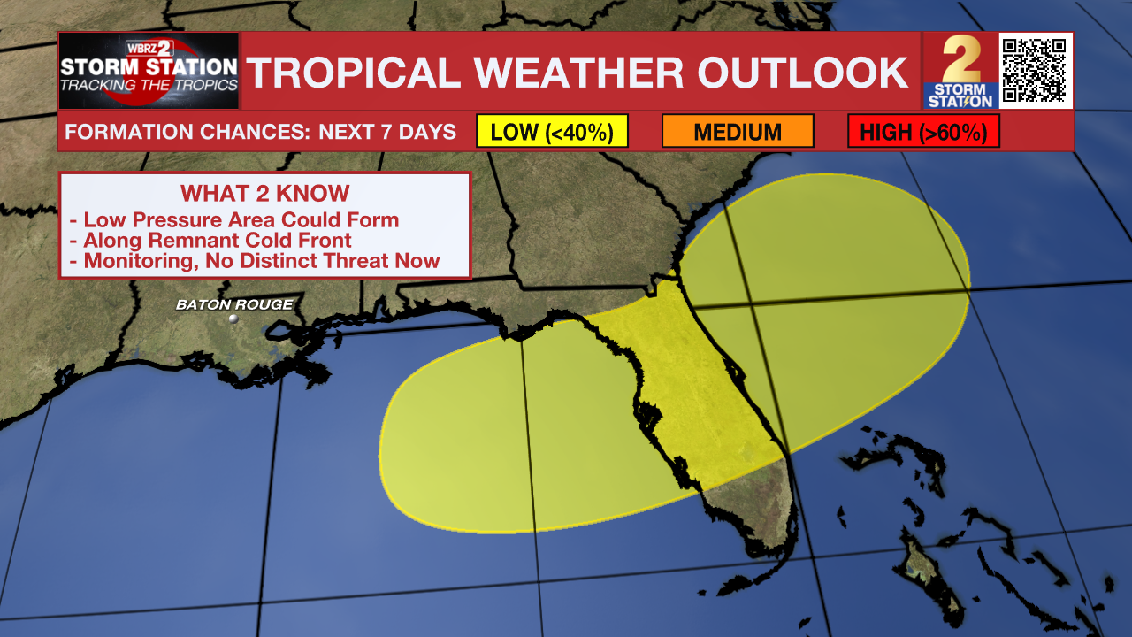
Looking Beyond: By Sunday and Monday, the drier spell should start to reverse. A tropical airmass is expected to return, helping to reignite scattered to numerous storms during the afternoon. However, the exact evolution of the pattern and extent of the rain coverage will be highly dependent on a weak disturbance we will be monitoring in the Gulf.
Trending News
The Tropics: A front is expected to stall and weaken off the southeast coast late this week. An area of low pressure could develop from the weakening front by the weekend off the southeast U.S., over Florida, or over the eastern Gulf. There is a 20% chance of gradual tropical or subtropical development as the low moves little.
Get the latest 7-day forecast and real-time weather updates HERE.
Watch live news HERE.
– Josh
The Storm Station is here for you, on every platform. Your weather updates can be found on News 2, wbrz.com, and the WBRZ WX App on your Apple or Android device. Follow WBRZ Weather on Facebook and X for even more weather updates while you are on the go.
More News
