

Latest Weather Blog
Monday PM Forecast: front moves into Metro Area late Tuesday into Wednesday
After many neighborhoods were able to dodge some pockets of heavy rain around the Capital City over Halloween Weekend, forecast focus turns to the next chance. A cold front will bring passing showers and thunderstorms late Election Day into Wednesday.
Cold Front: showers and a few thunderstorms Tuesday night into Wednesday
Drier Air: big drop in humidity
Cooler Air: expected behind a reinforcing front around the weekend

Trending News
Tonight and Tomorrow: With muggy air lingering across the Capital Area, low temperatures tonight will only dip into the mid to upper 60s around Baton Rouge, with some spots south of I-10 remaining in the low 70s. Expect mostly cloudy skies to persist overnight and into Election Day on Tuesday. Unseasonably warm weather will continue pushing high temperatures up to the mid-80s—especially for neighborhoods that see a few breaks of sun. An umbrella or rain jacket is a good idea to have by your side in case, though most rain showers will hold off until after sunset. A cold front will approach the Capital Area from the west, bringing scattered showers and a few thunderstorms from late evening into the night. Therefore, those voting closer to the time the polls close have the best chance of running into some wet weather, but the bulk of the activity will come during the middle of the night. A thunderstorm could produce briefly gusty winds, but significant severe weather is not expected. Rain amounts will stay on the lighter side, with most getting under a half an inch. Like the weekend, a few spots could stay entirely dry.
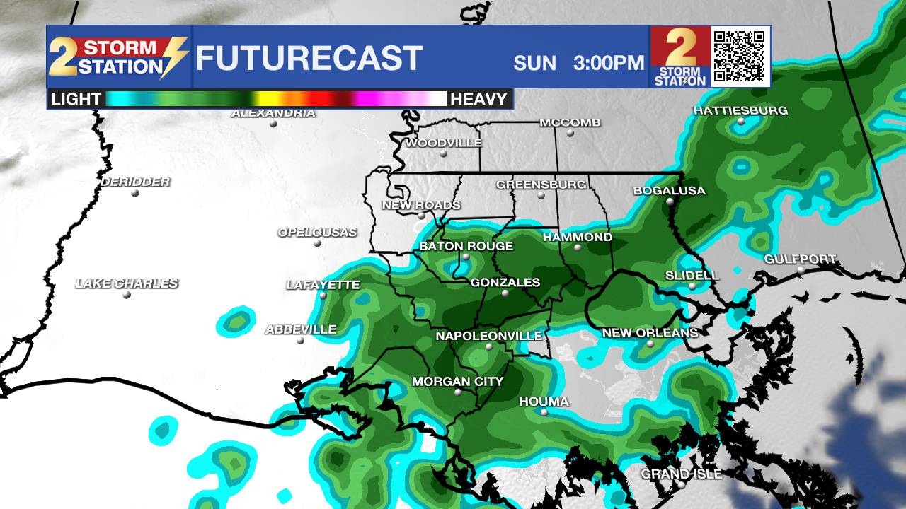
Use the slider to advance through the next 24 hours of Futurecast
Up Next: Damp roads and a few lingering showers will be around for some drivers on the Wednesday morning commute, but skies will begin clearing by Wednesday afternoon. Wednesday afternoon highs will peak around 79 degrees before crisp, drier air filters into the Capital Area.
Thursday will warm right back into the upper 70s. Sunshine will give way to increasing clouds late ahead of another fast-moving weather disturbance.
A weak front will pass through on Friday, triggering isolated showers (a 30% rain coverage). Skies will be mostly cloudy otherwise.
A stronger push of dry, cool air will follow closely behind for the weekend, dropping high temperatures into the lower to mid-70s for Saturday and Sunday. Meanwhile, nighttime temperatures will feel cool, tumbling into the lower 50s and upper 40s. By this time, there won’t be much moisture left in the atmosphere to support rain, but token 10% rain coverages are carried both days as some more fast-moving, weak disturbances could realistically stir up a passing shower. However, the details associated with these features should clear up closer to the weekend.
Get the latest 7-day forecast and real-time weather updates HERE.
Watch live news HERE.
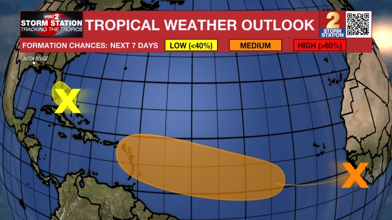
The Tropics: An area of low pressure is likely to form along a weakening front a few hundred miles northeast of the Bahamas in a couple of days. There is a low chance this system could acquire some subtropical characteristics late this week while it drifts over the western Atlantic. The chances of subtropical development should end by the weekend when the system is expected to move eastward or northeastward into unfavorable environmental conditions.
– Josh
The Storm Station is here for you, on every platform. Your weather updates can be found on News 2, wbrz.com, and the WBRZ WX App on your Apple or Android device. Follow WBRZ Weather on Facebook and X for even more weather updates while you are on the go.
More News

