

Latest Weather Blog
Sunday AM Forecast: August heat continues with daily pop-up storms, Three areas to watch in the Tropics
The next week features classic August weather — sizzling heat, sticky humidity, and just enough storms to tease some relief. While most days stay dry, keep an eye out for afternoon downpours.
Today & Tonight: Sunday brings plenty of sunshine and heat, with highs soaring into the mid-90s and heat index values peaking near 105°. Expect another steamy day! A few isolated storms may fire up in the afternoon and evening, with the better chance for rain south of the I-10/12 corridor. Still, a stray shower or two can’t be ruled out closer to Baton Rouge. Only about 20–30% of the area will see measurable rainfall. Tonight, skies stay mostly clear with lows settling in the 70s.
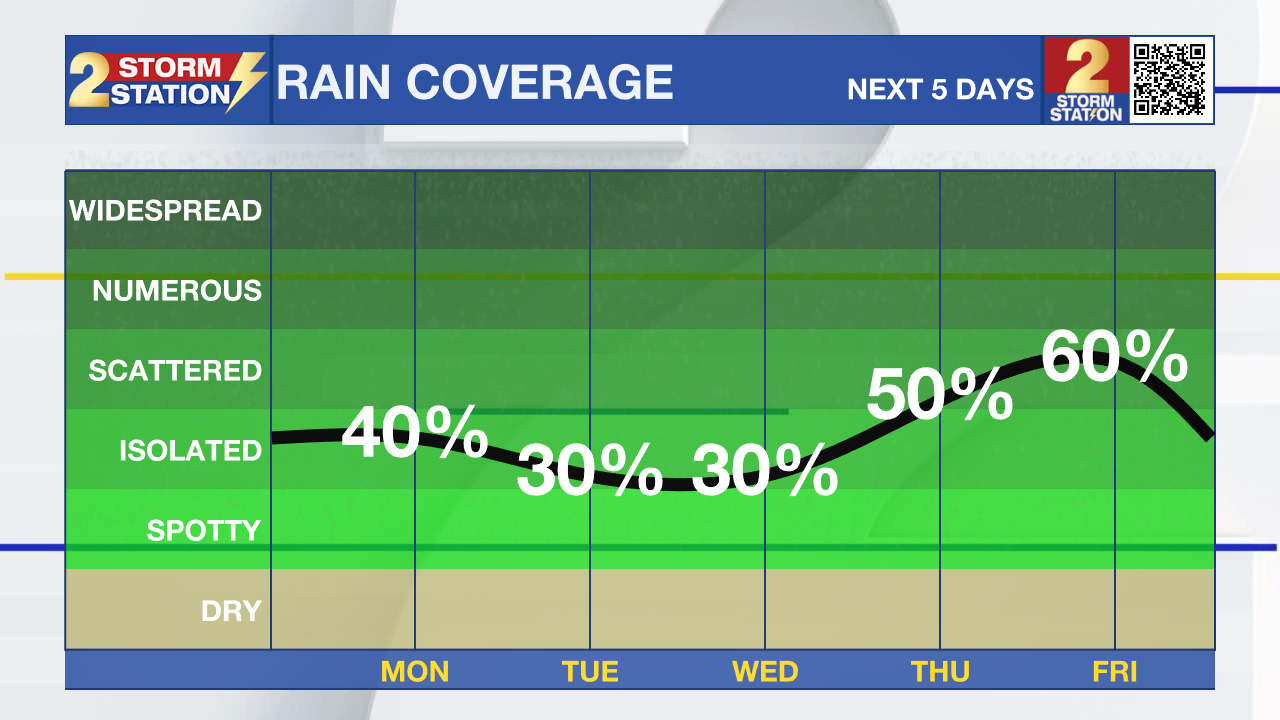
Up Next: The new workweek looks very typical for mid/late August—hot, humid, and occasionally stormy. Isolated afternoon downpours are possible each day, with about 20–30% of the region picking up rain daily through midweek. By Thursday and Friday, added moisture in the atmosphere and a trough dropping in from the northeast could bring a few more storms, but even then no washouts are expected. Highs will hold near normal, in the low 90s, with muggy mornings in the 70s.

Hurricane Erin: As of 7am Sunday morning, Erin has lost some of it's strength but remains a major category 3 storm as it moves northwest of Puerto Rico today. Erin will continue to take a northward shift over the next week, remaining a few hundred miles off the coast of the United States; maintaining category 3 strength or higher through midweek. Although no direct landfall is expected, the storm is continuing to grow much larger in size, and will lead to increasingly rough seas across much of the western Atlantic next week.
Trending News
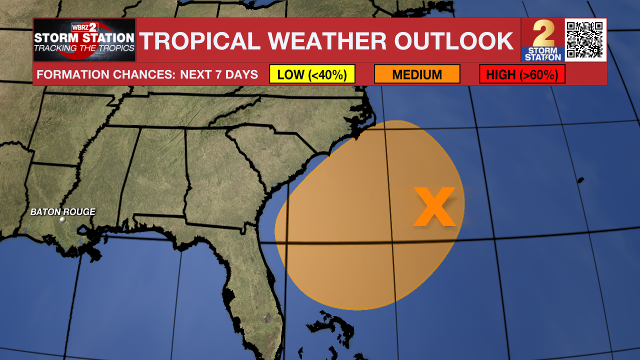
Northwestern Atlantic: A broad area of low pressure located a couple hundred miles off the coast of North Carolina is producing limited showers and thunderstorms well to the east of the center. Development, if any, of this system should be slow to occur during the next day or so while it drifts generally eastward. The opportunity for development should end on Monday when environmental upper-level wind conditions are expected to become unfavorable.
Central Tropical Atlantic: A tropical wave located near the Cabo Verde Islands is producing disorganized showers and thunderstorms. Some gradual development of this system is possible during the middle to latter portion of the week while the system moves westward to west-northwestward at 15 to 20 mph across the eastern and central tropical Atlantic.
Get the latest 7-day forecast and real-time weather updates HERE.
Watch live news HERE.
– Emma Kate C.
The Storm Station is here for you, on every platform. Your weather updates can be found on News 2, wbrz.com, and the WBRZ WX App on your Apple or Android device. Follow WBRZ Weather on Facebook and X for even more weather updates while you are on the go.
More News
